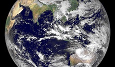
NESDIS IIAD builds relationships with government organizations around the world. This is a listing of the some of the key satellite systems and regions that we work with. NESDIS and NOAA could not accomplish all they do without scientific and data exchange with our partners built on years of cooperation and collaboration.
Europe
EUMETSAT:
Formed in 1986, the European Organisation for the Exploitation of Meteorological Satellites (EUMETSAT) is an international organization composed of 30 member states from across Europe that operates geostationary satellites over Europe and Africa and polar-orbiting satellites. NOAA and EUMETSAT signed a Long-Term Cooperation Agreement in August 2013, building on a 30-year partnership in geostationary, polar-orbiting, and ocean altimetry satellites that has brought tremendous cost-saving benefits and increased the robustness of our observing systems. Contact: Matthew Butler.Japan
JMA:
The Japan Meteorological Agency is Japan's operational weather forecasting and meteorological satellite agency. NOAA and JMA have mutual back-up arrangements for geostationary systems, and NOAA and JMA next-generation satellites will carry similar advanced imagers. JMA and NOAA actively participate in the Coordination Group for Meteorological Satellites. Contact: Jennifer Clapp.Japan
JAXA:
The Japan Aerospace Exploration Agency conducts space research and development from unmanned to manned space activities. NOAA has a longstanding partnership with JAXA, most recently providing for cooperation in JAXA's Global Climate Observation Mission–Water (GCOM-W1) for key observations on the water cycle. JAXA is a founding member of the Committee on Earth Observation Satellites (CEOS). Contact: Jennifer Clapp.Europe
ESA:
Formed in 1975, the European Space Agency is an independent international organization composed of 22 member states from across Europe. In addition to exploring our solar system and supporting human spaceflight through its astronaut corps, ESA has a robust Earth observation program. ESA is also launching and operating, in coordination with the European Union and EUMETSAT, a series of Sentinel satellite missions which will provide key Earth observation data to users around the world. Contact: Matthew Butler.Taiwan
NSPO:
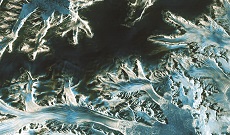
The National Space Organization was established in 1991 to execute Taiwan’s space program and develop technology infrastructure for space development. NOAA coorperates with NSPO on the FORMOSAT-3/COSMIC (Constellation Observing System for Meteorology, Ionosphere and Climate), a constellation of six satellites that launched in 2006 and demonstrated the use of Global Positioning System (GPS) radio occultation in an operational environment for weather prediction, space weather observation, and global change research. A follow-on mission, FORMOSAT-7/COSMIC-2, is under development. Contact: Jennifer Clapp.France
CNES:
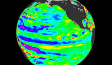
NOAA works with the Centre National d'Études Spatiales (French Space Agency) in several areas. Since 1978, Argos, a data collection and location relay system administered under an agreement between NOAA and CNES, collects a wide variety of in situ measurements, including data on atmospheric pressure, sea temperature, ocean current velocity, animal migration patterns, and river water levels. In addition, NOAA works with CNES on the joint CNES-NASA TOPEX/Poseidon altimeter mission, initially launched in 1992 and expanded in 2008 with the launch of Jason-2 and again in 2016 with the launch of Jason-3. NOAA and EUMETSAT cooperate to operate the Jason-2 and Jason-3 satellites. Contact: Albert DeGarmo.Canada
CSA:
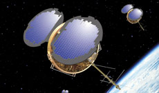
The Canadian Space Agency has been NOAA's partner since its founding in 1989. In 1991 NOAA and NASA partnered with CSA on the RADARSAT-1 (R-1) mission. The R-1 satellite was launched in 1995 and was operational until 2008 when the RADARSAT-2 (R-2) came online. NOAA and NASA continue to work with CSA on the replacement for R-2, the RADARSAT-Constellation mission (RCM). NOAA is also working closely with CSA on the proposed Polar Communication and Weather mission (PCW), also known as PolarSat. NOAA and CSA cooperate closely in GEO and other international space fora. Contact: Eric Madsen.China
CMA:
The China Meteorological Administration has been responsible for China’s national meteorological services since 1994 and operates primary and backup geostationary satellites over Asia and the Pacific as well as several polar-orbiting satellites (morning and afternoon orbits). NOAA and CMA cooperate bilaterally through the Atmosphere Protocol of the U.S.-China Agreement for Science and Technology, originally signed in 1979. NOAA has welcomed CMA's willingness to accept leadership roles in key international bodies such as the Group on Earth Observations and the Committee on Earth Observation Satellites. Contact: Mary Ann Kutny.Korea
KMA and KARI/KASI:
The Korean Meteorological Administration provides weather forecasts and warnings. In 2010 KMA successfully launched its first weather satellite, COMS-1. KMA and NOAA cooperate under the KMA-NOAA Protocol on Cooperation in the Field of Atmospheric Science and Technology. NOAA/NESDIS and KMA/ NMSC focus on cooperation in algorithm development, satellite product visualization, and technical use of data. The Korea Aerospace Research Institute (KARI) is the aeronautics and space agency of South Korea, and the Korea Astronomy and Space Science Institute (KASI) develops applications of space data. KARI and KASI are responsible for KOMPSAT-5, which offers Global Navigation Satellite System radio occultation (GNSSRO) data of interest to NOAA. Contact: Mary Ann Kutny.India
ISRO and MoES:
The Indian Space Research Organisation is the research and development wing of India's Department of Space. On 23 March 2012, NOAA and ISRO concluded and formally signed an Implementing Arrangement (IA) on Oceansat-2 collaboration. The IA codifies cooperation between the two agencies in ocean wind and ocean color activities. Access to these data have helped mitigate the loss of scatterometer data from NASA's QuikSCAT. NOAA also works with the Indian Ministry of Earth Sciences (MoES). NOAA and MoES signed an MOU for technical cooperation in Earth observations and Earth sciences in April 2008, and an Implementing Arrangement for INSAT-3D in October 2010. Contact: Kerry Sawyer.Europe
EC:
The European Commission (EC) is managing the European Union's space programs. NOAA and the EC's Joint Research Centre have an Implementing Arrangement for cooperation in such areas as tsunami modeling and climate observation metadata. NOAA also is cooperating with the EC's Copernicus Program, which collects data from sensors on water, land and from its Sentinel series of satellites. Under the Copernicus Cooperation Arrangement signed by the United States and the EC in October 2016, NOAA receives synthetic aperture radar, altimetry, ocean color, and atmospheric chemistry data from the Sentinel missions. Contact: Matthew Butler.Australia