Openly accessible scientific data, including data from environmental satellites observing the Earth from space, is a key tool for forecasting weather, analyzing climate, and monitoring hazards worldwide. NOAA's Satellite and Information Service operates many environmental satellites and archives NOAA's weather, climate, and ocean data; however, no one country can afford to effectively monitor the entire Earth.
In an effort to overcome this challenge, NOAA provides access to its data on a full and open basis and serves as a leading advocate for this policy internationally. The NOAA and U.S. commitment to open data sharing is outlined in the Principles for Promoting Access to Federal Government-Supported Scientific Data and Research Findings Through International Scientific Cooperation and the National Space Policy of the United States of America. As a result, the U.S. government, companies, and universities receive a wealth of global data vital to weather forecasting, climate services, and hazard monitoring.
The NOAA/NESDIS International and Interagency Affairs Division works to advance this US policy abroad by developing partnerships, providing others with access to data, and coordinating global Earth observations.
Coverage by one polar-orbiting satellite over six hours.

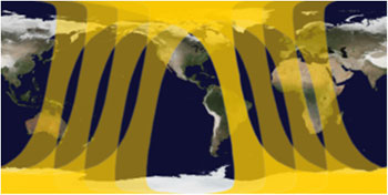
Coverage by two polar-orbiting satellites over six hours.