NESDIS IIAD facilitates access to NOAA data for non-NOAA domestic and international partners in support of weather forecasting, science and protection of life and property. In addition, IIAD provides capacity building support.
GEONETCast
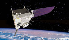
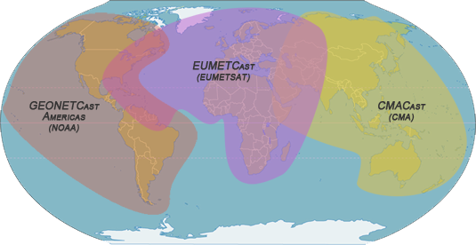
GEONETCast is a global network of satellite-based data dissemination systems providing environmental data to a world-wide user community. The current partners within the GEONETCast initiative include the China Meteorological Administration (CMA), NOAA, the World Meteorological Organization (WMO) and EUMETSAT, as well as many prospective data provider partners. GEONETCast receiving technology is based on using widespread and off-the-shelf components allowing for widespread adoption of the service at low cost. An entire receiving station can be purchased and installed for US$2,000–3,000. GEONETCast includes three broadcast streams: 1) EUMETCast, 2) CMACast, and 3) GEONETCast Americas. A map of coverage areas is at the top of this page. Contact: Eric Madsen.
GEONETCast Americas
GEONETCast Americas is the Western Hemisphere component of GEONETCast, a near real time, global network of satellite-based data dissemination systems designed to distribute space-based, air-borne and in situ data, metadata and products to diverse communities. It is maintained by NOAA and its main partners in Latin America and the Caribbean are INPE, the Brazilian Institute for Space Research, and IMN, Costa Rica's Met Service. It broadcasts environmental and other observation data to an area covering most of North, Central, and South America using the commercial Intelsat-9 (IS-9) satellite. A map of coverage is at the top of this page. Users throughout the region can pick up the broadcast using inexpensive satellite receiver stations. Contact: Martin Medina.
Operational Access
The NOAA Office of Satellite and Product Operations manages and directs the operation of the central ground facilities which ingest, process, and distribute environmental satellite data and derived products to domestic and foreign users. Access to NOAA satellite data and products are provided via publically-available dsitribution services such as the Global Telecommunication System (GTS), NOAA satellie direct broadcast services and Internet websites. Direct, operational access to NOAA Environmental Satellite Processing Center (ESPC) servers is evaluated based on the purpose of the request. Contact: Eric Madsen.
Archival Access
NOAA's National Centers for Environmental Information (NCEI) are responsible for hosting and providing public access to one of the most significant archives for environmental data on Earth with over 20 petabytes of comprehensive atmospheric, coastal, oceanic, and geophysical data. In addition, most data can be accessed online through the Comprehensive Large Array Data Stewardship System (CLASS). Contact: Mary Ann Kutny.
Capacity Building
NOAA understands that the effective use of Earth observation (EO) data is essential for the understanding and stewardship of our planet. However, effective use of EO data first requires building the capacity to use that data worldwide. The method that NOAA employs to build capacity is an approach termed Data Democracy: the provision of timely access to key data sets free of charge, enhanced data dissemination capabilities, sharing of software tools, increased training, and technology transfer to end users. NOAA maintains a number of bilateral capacity building programs, but it also leads multilateral capacity building initiatives in the Group on Earth Observations (GEO) and the Committee on Earth Observation Satellites (CEOS). Contact: Albert DeGarmo.